
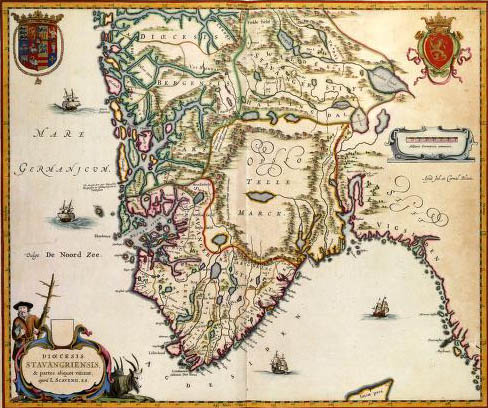
03 - DIOECESIS STAVANGRIENSIS, Apud Joh. et Cornel. Blaeu (1638).
 |
|||
|
|||
| DIOECESIS STAVANGRIENSIS, Apud Joh. et Cornel. Blaeu (1638). Beginning 17th century, the Bisshop of Stavanger, Laurids Claeusen Scavenius (1562-1626), drew up a survey map of his bisshopry, the Stavanger Stift. Although the map did present a reliable representation it is questioned that all small islands in the area of fjords are represented correctly. From the third quarter of the 17th century onwards several enhanced exemplaries appeared in Dutch atlases. This map was published in 1638 by the brothers Joan (1598-1673) and Cornelis Blaeu (c. 1610-1642). | |||
|
|