
05 - LALANDIA FALSTRIA et MONA, (1662)
 |
|||
|
|||
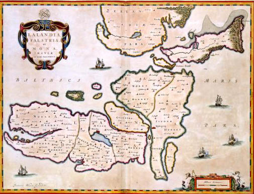
| LALANDIA FALSTRIA et MONA, INSULAE IN MARI BALTHICO, Joan Blaeu (1662)This map of the Danish islands Lolland, Falster and Mon was published in 1662 in the Atlas Maior by Joan Blaeu (1598-1673). The map gives a contemporary view of the islands. For this map, Blaeu had at his disposal the results of a recent topographical survey of the Danish kingdom which was carried out in 1631 under orders from king Christian IV. | |||
|
|